ENSO Blog
The Pacific Ocean has hit pause and settled into ENSO-neutral conditions, which are expected to continue through the Northern Hemisphere summer. This makes seasonal forecasting for upcoming global rain, temperature, and other patterns a bit trickier.
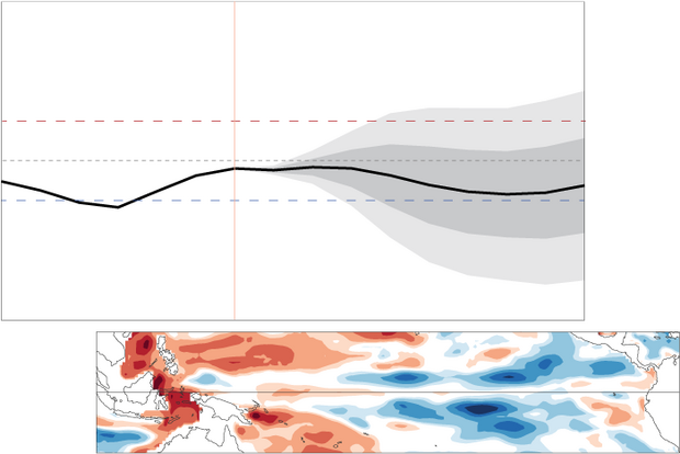
The odds of La Niña increase through the fall but remain lower than the odds of neutral. By the November–January period, there’s a 48% chance of neutral and a 41% chance of La Niña, with El Niño a distant third. Grab your towel, today we’re touring the galaxy of ENSO-neutral and what it means for seasonal prediction.
The story so far: what ENSO is, and why it matters
El Niño and La Niña, known collectively as the El Niño/Southern Oscill…
Read article
This is a guest post by Prof. Kelsey Malloy, with the Department of Geography and Spatial Sciences at the University of Delaware. She specializes in diagnosing the influence of climate on severe convective storm risk. She is also an accomplished blogger at Seasoned Chaos, which focuses on subseasonal-to-seasonal forecasting.
*****
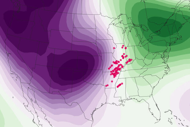
On your mark, get set, go! The 2025 U.S. severe weather season is off to a formidable start. Preliminary storm report data from Storm Prediction Center (SPC) suggest a well above-average February through April, especially for tornado activity, which has tragically resulted in 35 deaths [footnote 1]. What goes into such an active tornado season? As the blog ha…
Read article
The tropical Pacific is in ENSO-neutral conditions, and neutral is expected to continue through the Northern Hemisphere summer. Neutral is also the most likely outcome for the fall and winter, although chances of La Niña are a close second. Today, as your trusty representative of the ENSO forecast team, I’ll cover current conditions in the tropical Pacific, what we mean by neutral, and what it means for seasonal climate prediction… with a side of Macbeth (footnote 1).
The ENSO cauldron
First, let’s set the stage for why we care so much about El Niño and La Niña, the natural climate pattern collectively known as ENSO, the El Niño/Southern Oscillation. El Niño and La Niña change global a…
Read article
Put any meteorologist or scientist on the spot and ask them to define the climate in 10 seconds or less, they will blurt out some variation of “climate is the average of weather” (I’m guilty of this!). And, while it’s true in a narrow sense, it doesn’t provide a complete picture. We can’t expect to fully understand—much less predict—a location’s climate just by averaging its day-to-day weather. Let me explain by comparing the climates of Washington, D.C. and the Galapagos Islands.
In Washington, D.C., we are in the midst of spring. The tulips are out, the trees and grass are bright green, the pollen is smothering, and while there are still a few crisp, cool mornings, everyone knows wi…
Read article
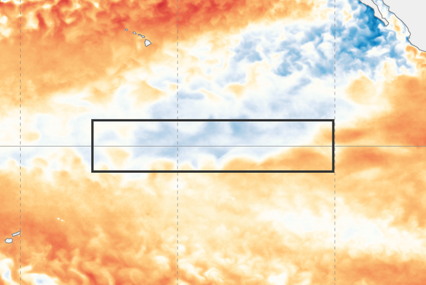
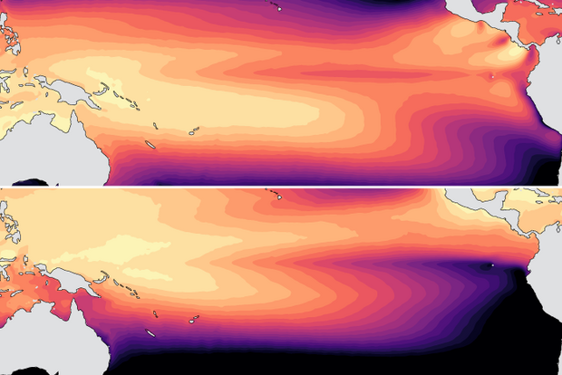
After just a few months of La Niña conditions, the tropical Pacific is now ENSO-neutral, and forecasters expect neutral to continue through the Northern Hemisphere summer. Neutral is also the most likely state through the fall (greater than 50% chance).
What is ENSO? What does neutral even mean?
ENSO stands for “El Niño/Southern Oscillation,” a pattern of changes in the temperature of the ocean surface and atmospheric circulation of the tropical Pacific region. La Niña means the surface water is cooler than average, the trade winds are stronger, and the central equatorial Pacific receives less rain. On the other hand, El Niño is represented by warmer surface water, weaker trade winds, …
Read article