
Image caption
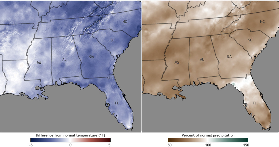
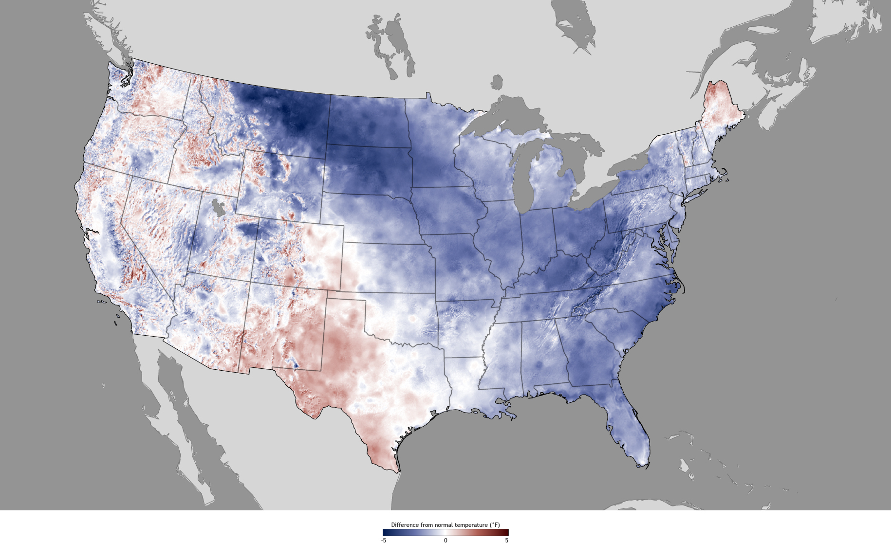
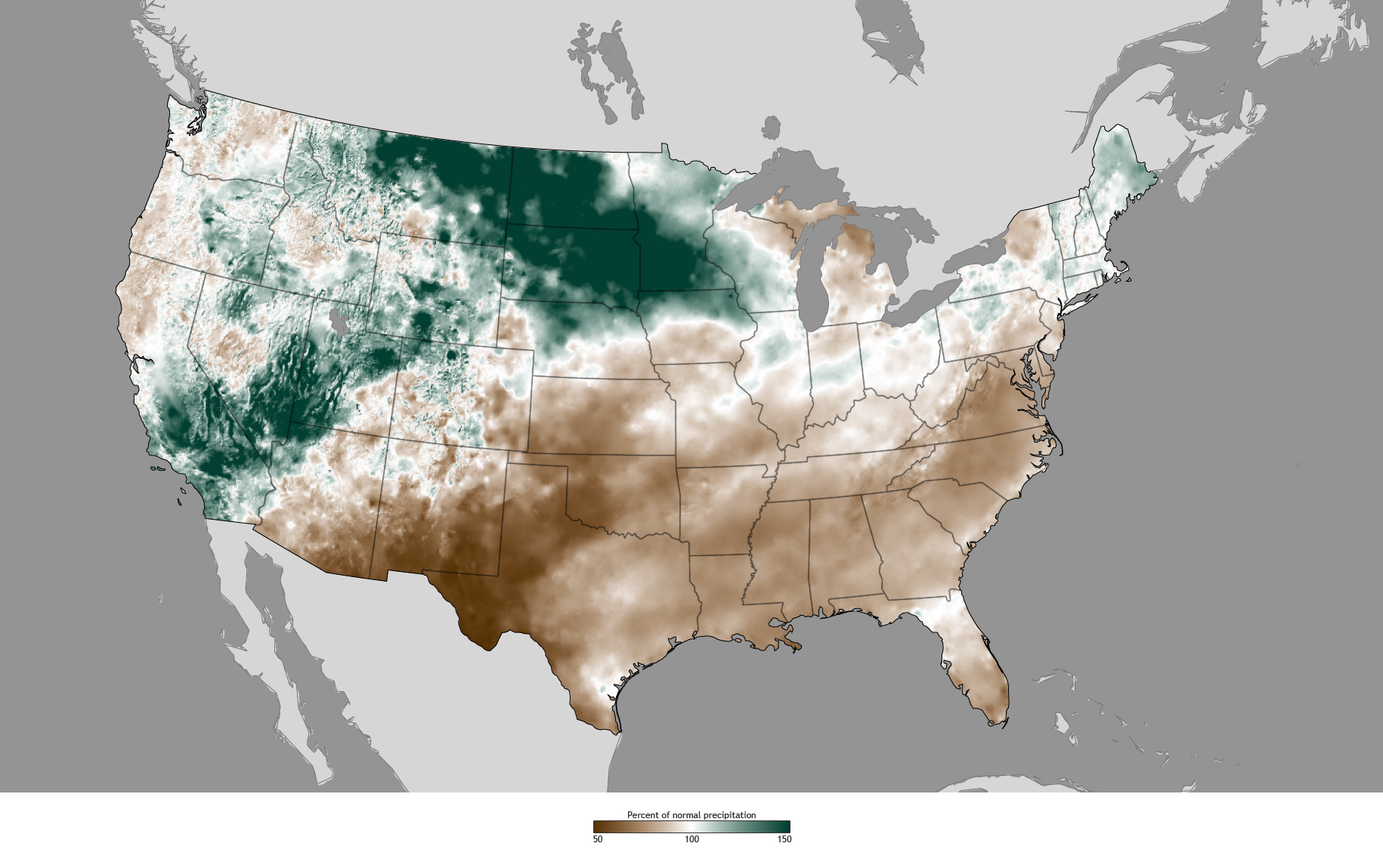
Contrary to the forecast, winter 2010-2011 temperatures in the Southeast were several degrees cooler than normal, in large part due to an unpredictable climate pattern called the North Atlantic Oscillation. Precipitation was consistent with the forecast, however, leaving the Southeast drier than normal (shades of brown). NOAA maps by climate.gov team, based on temperature and precipitation data provided by the PRISM Climate Group at Oregon State University.